
Do you want to teach geography to your children? Do you have the resources to teach geography? Do you have a young child interested in maps and your not sure what direction to take? Please take the time to read this review and see how I used Knowledge Quest's Map Trek maps to teach geography to my 4 1/2 year old daughter. Please continue reading this review because you may still find an age appropriate activity that you would like to try with your children.
I remember failing a geography test when I was younger. I had to stay after school to study and label the entire thing all over again in hopes to raise my grade. I was upset that I had to use my time after school to do more school. I have never been good at reading maps ... my husband will agree. I was prepared to learn something new and to teach Alyssa how to read and use maps so that she doesn't have the same handicap when she gets older. Maps tell you a lot of information about the world then and now. There are many kinds of maps with different uses or purposes. I wanted my daughter to LOVE maps and globes ... so far so good. I don't want her to be intimidated as I was or to have bad experiences that limit her potential.
I was absolutely, positively ectatic when I found out that I would be a reviewer for Map Trek's 6 E-Book Complete Map Collection published by Knowledge Quest and Bramley Books (a division of Knowledge Quest Inc.). I wanted to challenge myself. I wanted to find a way to make geography and mapping fun for us both of us. The creator of these maps, Terri Johnson, has developed a set of maps that makes this challenge simple and easy to conquer. In the past, Alyssa enjoyed doing map and globe activities. She's always been drawn to a gorgeous globe found at one of our local libraries. She would ask me, "Mommy can I look at the globe before we go." I neglected to continue geography studies as much as I desired to expose her to the world due to lack of resources and time. Map Trek motivated me again! I have no reason to neglect geography now. In fact, I plan to continue teaching geography throughout the year using several of the ideas presented in my review and in their lesson plans.
Product Description
FINALLY! I have been waiting forever to tell you about this product that was on my wish list for months and months. We were honored to review the Map Trek 6 E-Book Collection by Knowledge Quest created by Terri Johnson. Map Trek is a complete collection of outstanding maps in e-book format for grades 1-12! It is an atlas with historical outline maps tied into one package. Each map set contains a table of contents, an introduction to why we study history, lesson plans, maps, and a glossary. The e-book map sets are complete with student and teacher maps. The student maps are blank and unlabeled maps with slight blue shadings that indicate bodies of water as a guide for children. The teacher maps are in full-color and labeled maps so that they can be used as an answer keys. If you purchase this complete e-book collection then you will receive everything you need to teach World and American History in six volumes. This collection contains over 465 pages in total ... that's 350 World maps and 235 American maps plus additional resources including a glossary of terms and lesson plans. The best part about it is that well-written, differentiated lesson plans are included in the map collection. The lesson plans are extremely helpful, informative, and simple to use. Lesson plans are included for various age levels or groups. The activities allow children to work at their own ability or pace. For example, Alyssa often worked on several activities from Levels A and B. Occasionally she would attempt a Level C activity. I was able to use the maps and lesson plans to meet her needs. I also used the lesson plans as a checklist of things accomplished during a study. If we completed an activity, then I would highlight or place a check mark next to the activity. This allowed me to see what needed to be covered in the future.
The lesson plans are divided into three levels of difficulty:
This complete e-book collection includes six volumes. Let me explain it a bit further. World history is broken into four chronological time periods and with the Map Trek 6 E-Book Collection you receive all four and the two US Map sets. Click on the time period or US Map links below to see what maps are included in each set.
In addition to the sets above, you will receive the two sets of US Maps as seen below:

The lesson plans are divided into three levels of difficulty:
- Level A (Grades 1-4)
- Level B (Grades 5-8)
- Level C (Grades 9-12)
 |
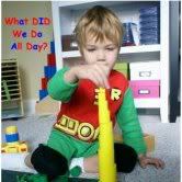
| Christopher Columbus Lesson Plan Activity Sample from US Historical Map Set |
In addition to the sets above, you will receive the two sets of US Maps as seen below:
- USA Historical Maps
- Individual State Maps (GREAT for state studies)

Cost
The Map Trek Complete Collection Six E-Book Set costs only $47.00. Look at it this way, if you divide the $47 cost into 12 years is comes out to be less than $4 a year. This is an outstanding deal for 12 years of geography maps and lessons! Your geography lessons are planned and ready to go for the rest of your child's schooling years. If you wanted to purchase the CD-ROM format for both the World and USA map sets then you would pay $49.95 plus shipping and handling. You can also purchase a hard cover book with CD-ROM for $55.00. If you only need one particular set, the map sets can be purchased individually or separately ranging in cost from $14.95-$19.95.
Reactions
I am sure that by viewing the activities and photos that follow throughout this review, you'll see that Alyssa didn't suffer when learning geography with this map collection. Every time I tell her its time for history and geography she gets excited and asks me what were are going to learn. One of the greatest joys of a homeschool mother is knowing that children love to learn and have the ambition to show what they have learned. We are both enjoying geography studies now. I am learning just as much as Alyssa.
Helpful Materials - Not All Are Necessary
- Obviously a computer and printer are required for an e-book
- Globe
- Wall Maps
- Historical Atlases
- Chronological History Curriculum
- Art supplies including crayons, colored pencils, glitter, glue, watercolors, etc.
Pros
- The recently revised and updated maps are beautifully designed with detail.
- The company used high resolution vector graphics providing users with clean and clear maps of better quality.
- There are lesson plans written and available for each map set saving you planning and preparation time in the long run. The lesson plans are all about 20-27 pages long.
- The maps and lesson plans cover the subject of geography from first grade to twelth grade. They suggest age appropriate activities and ways too implement them in your home or at school. You wouldn't need anything else except for a chronological history spine to use along with the maps. This map collection is an absolute must have for larger families since it covers all grade levels. You can adapt or modify further for younger children in preschool or kindergarten as I have done. This map set allows you to print multiple copies of the same map for each child in the family enabling you to study the same time period together.
- Historical and chronologically sequenced maps are downloadable in PDF format as e-books for immediate use and quick delivery for most computers. Adobe is used to open PDF files and it is FREE.
- The useful and attractive maps can be used in conjunction and correlate with any chronological history curriculum whether christian or secular in nature. If using this map collection with a secular curriculum, you can eliminate the Biblical-based maps.
- There are accurate maps representing the past and what the world looks like present time today.
- You print only what you need at that time - this is a great benefit and saves on the cost of ink. I am sure that many people will view the teacher maps on their computer to save ink and paper costs. I found it awkward looking at a map sideways so we ended up printing out the teacher maps we used.
- This map collection set has saved me an enormous amount of time. The time I would have spent searching the internet literally for hours can now be used to teach or spend time with family. I do not need to search for maps because with this set they are all readily available to me.
- For those of you teaching with a classical approach, this map collection has been recommended by The Well-Trained Mind (Susan Bauer).
- Teacher maps are available in full-color and the student outline maps are blank, unlabeled with slight color shadings to indicate bodies of water. Using less color on the maps makes them fairly inexpensive to print.
- They include an updated correction page on the website for any errors in their products.
- There is a glossary of relevant terms provided for each map set. This resource can be used to create hands-on vocabulary or geography games. This is also a great tool when explaining words to your children during a particular unit or study.
- The curriculum integration guides are fantastic resources to guide your family through history using a particular curriculum. The map titles and/or page numbers indicate which map to use and when to use it.
- A compass rose can be found on many maps (if not all) indicating the cardinal directions.
- The lesson plans and maps encourage independent learning and self-checking responsibilities. The interests of your children will be sparked and they may desire to create their own learning activities.
Possible Cons
I am at a loss here! Anyone have suggestions? I really can't think of any major dislikes or possible cons for this list. I love this map collection and will use it every single week possibly on a daily basis! This is what I came up with as possible cons for some individuals.
Possible Improvements
Knowledge Quest I think you have done it! Consider adding page numbers on the two maps sets mentioned above if you decide to revise editions in the future. I prefer using page numbers as a checking reference - making sure that the maps correlate correctly with the indicated curriculum guide page numbers. The titles on the actual maps did allow me to double check the maps in use.
How We Used Map Trek Maps (Modifications are Highlighted)
- I did notice that the map pages were not numbered in the Ancient Map Set or the Medieval Map Set. I found it much easier and helpful to use the the sets with page numbers. This will be beneficial to individuals printing out the entire book and for those using the curriculum integration guides. However, the map title is found at the top of each map and within the curriculum integration guides as a reference.
- The large downloadable e-book PDF files may have trouble downloading quickly on slower computers. You can contact the company with any downloading issues and they will be happy to help. We did not have any issues downloading the e-books. They downloaded very quickly for us.
- Printing cost would have to be considered should you decide to print and bind all materials in this collection. You could print one map set at a time to spread out the cost. The company has made it as cost effective as possible by limiting the amount of color used on student maps. Teacher maps can always be viewed on the screen but I prefer to print them.
Possible Improvements
Knowledge Quest I think you have done it! Consider adding page numbers on the two maps sets mentioned above if you decide to revise editions in the future. I prefer using page numbers as a checking reference - making sure that the maps correlate correctly with the indicated curriculum guide page numbers. The titles on the actual maps did allow me to double check the maps in use.
How We Used Map Trek Maps (Modifications are Highlighted)
This is my favorite part of the review! I have been looking forward to writing this part of the review part for weeks. Now the time has come! I can't tell you how wonderful Knowledge Quest Map Collection is ... well, I think I already did. If not you'll hear me say it a couple of times before the end of this review. I wanted to share a few ideas on how to use these maps especially with younger children. Map Trek suggest using maps at least once a week. I can tell you now that we use them every day we do school. Now that I have the specifics about the actual product out of the way ... I want to show you how we used the maps included in this collection.
As an introduction to maps, I read a book titled, Maps and Globes by Jack Knowlton to my daughter. We discussed the purpose of both maps and globes and when to appropriately use them. We compared globe use to map use using a Hula Hoop Venn diagram and index cards. Turning worksheets into hands-on activities is a way to modify.
As an introduction to maps, I read a book titled, Maps and Globes by Jack Knowlton to my daughter. We discussed the purpose of both maps and globes and when to appropriately use them. We compared globe use to map use using a Hula Hoop Venn diagram and index cards. Turning worksheets into hands-on activities is a way to modify.
Map Drills
I wanted to use the maps more often so I started doing map drills a couple times a week based on Charlotte Mason's methods. You can find out more information about map drills on Simply Charlotte Mason's Geography post. I used map drills with the unlabeled outline maps for the continents. First, Alyssa had the task of studying the world or continent map in order to locate and label the seven continents. She breezed through this activity and completely shocked me with the amount of information she remembered. Although, we have been playing a lot of geography games and completing Geo Puzzles for years. I am sure the puzzles have helped her tremendously with becoming familiar with the location of the continents. She labeled all of the continents correctly the first time. The next day her goal was to label all of the continents and oceans correctly on the map. She circled Pacific because she wasn't sure if it was in the right location. I showed her the teacher answer map and she corrected any errors immediately (if needed). Charlotte Mason's methods were also used to study the teacher map of Texas. Alyssa had the responsibility to label the blank student USA map with state abbreviations after studying it for several minutes. This activity will take much longer for her to complete successfully and we are in no rush. You can extend the study time based on the child's needs and abilities. Make sure you provide a random list of state abbreviations for younger children.


History Supplement


Did you know that Knowledge Quest created FREE Curriculum Integration Guides that tell how to use their maps with many well known, popular history curriculums? I was seriously overly excited when I found that there was a guide that correlated with a history spine curriculum that we are currently reviewing over the summer. I used Knowledge Quest's curriculum integration guide with Diana Waring's curriculum as a supplement to our world history studies. They also have curriculum integration guides for Story of the World, Streams of Civilization, TruthQuest, Ambleside, and A Child's History of the World. I hear that there are more guides on the way ... so check back often for updates. There are many other curriculums mentioned so take time to check them out and print what you need for the upcoming year. Contact the company if you would like to know if they are working on guides for specific curriculums.
The Ancient Map Set came in handy during our Ancient Civilization study. We used them to familiarize Alyssa with the continents, to note the possible location of the Garden of Eden, to label the possible locations of Noah's descendants, to label bodies of water, to indicate the ancient city locations, to trace Abraham's Journey, and to show the route taken when leaving Egypt (Exodus) - just to name a few. There are many connections that can be made to the maps during this study. In the photos below, you will see a few activities that Alyssa completed. First, she studied the world map in order to locate and label the seven continents. Then, she labeled the Descendants of Noah map. I will tell you that I randomly wrote the names of the places I wanted her to label on a large index card due to her age. I wanted her to focus more on the actual locations of the places and not stress or get frustrated with the spellings. You could also write them on a mini dry erase board and have your child cross the locations out when labeled.


Then, we did a "following directions" activity to see if she could locate Egypt with a 3-D pyramid. Instead of creating a worksheet, I used the maps to do another hands-on activity with manipulative. I gave her verbal commands based on cardinal directions and she moved the pyramid on the page. She did end up finding out where Egypt was located while learning about and cardinal directions (north, south, east, west). I think she remembered locating Egypt on the map from a previous study. We have studied ancient civilizations in the past. This map was also used as map drill activity. She studied the map for several minutes and labeled it. Notice the compass rose on the map in the bottom left corner. To make it more difficult, you could remove the compass rose with white out or cover it with thick dark colored paper.


Texas State Mini Unit
We read the book Me on the Map by Joan Sweeney. I asked Alyssa to use resources and the internet to figure out where our town would be on the state map. We used this website to obtain our information. She clicked on the red button for Canyon Lake and saw that it was between San Antonio and Austin. She labeled the location of our town on the state map, the capital for Texas, along with several other locations of family members. She later decided to fill in the rest of the cities on her map using the teacher map. We extended the study of Texas by discussing the state facts presented on the map. We used Homeschool Share's United States Geography Resources for our state symbols. Alyssa cut out and glued the pictures representing our state directly on her map. You could also have the child draw the state representations instead of completing a cut and paste activity. This will go in her geography notebook. In addition to many other books read, we viewed several videos about Texas using our Zane Education subscription. Be sure to check my blog soon for the upcoming review of Zane Education!


 |
| Alyssa's finished product - I think she did an awesome job! |

Push Pin Maps: Connecting Children's Literature to Geography
Maps can bring books alive and take you to other places around the world while still being in the comfort of your home. Another way that I used these amazing maps was during read aloud sessions. After reading a book aloud, we discussed the setting of the book and if any other locations were mentioned in the book. Alyssa used a push pin to mark locations mentioned on both USA and Continent Maps. The maps were clipped on the front and back side of a cork board. She also colored in and labeled a corresponding blank map. This activity can be done with a variety of genres including but not limited to folk tales, fables, non-fiction, and fiction. We used several websites and atlases to help research the region information. This activity can also be used for independent readings. By having the teacher read aloud the book, the child can focus on the geography setting while enjoying the story.
We used color-coded push pins to indicate five basic regions of the USA when pinning locations. I wanted to use color-coded push pins based on the colors used in Montessori geography studies but realized quickly I was missing the colors pink and brown. Two very hard to find push pin colors. You could also trace around the outlines of the the five regions on the teacher map to create a visual for the learner when pinning.
Pinning 5 Basic USA Regions
Northeast - White
Southeast - Blue
Southwest - Red
Midwest - Yellow
West - Green
Here is a list of a just a few books that we read (mentioning states and continents) to get you started. This is not all of the books we read and pinned. Do you have a great book to suggest? Please let me know the titles and age range in the comments section. I plan to start a specific post on my blog about this activity and will try to add them to the list as time allows. This was not an activity mentioned in the Map Trek lesson plans ... it was an activity I was inspired to create one day while using the maps. The end result is a more colorful pinned map indicating five general or basic regions of the United States. You could use the more advanced geographic regions and terms for older children using additional push pin colors. This activity helps children see the regions of the United States as they read.
United States of America
- Armadillo Rodeo by Jan Brett - Texas
- The Armadillo from Amarillo by Lynne Cherry - Texas
- Flat Stanley by Jeff Brown - California (The Flat Stanley Project is another way to tie in geography.)
- The Statue of Liberty by Lloyd G. Douglas - New York (France was also mentioned)
- A Day's Work by Eve Bunting - California
- Potato: A Tale from the Great Depression by Kate Lied - Washington, D.C. and Hawaii
- Me on the Map - Kansas (North America also mentioned)
- Tar Beach by Faith Ringgold - Research the George Washington Bridge to find the location on the map
- Form Here to There by Margery Cuyler - Texas (We researched to see if Splendora, Texas was a real city in Liberty County.)
- A Picture Book of Thomas Jefferson by David Adler - Virginia (We read this book near the Fourth of July. We pinned it on the USA map and I showed her the thirteen colonies map.)
Continents
- Miriam and Her Brother Moses by Jean Marzollo- Africa
- Me on the Map by Joan Sweeney - North America
- Exodus or Moses by Brian Wildsmith (Alyssa noticed that these two books were exactly the same)
- A Coat of Many Colors by Jenny Koralek - Israel or Egypt
- The Empty Pot by Demi - China
- The Egyptian Cinderella by Shirley Climo - Africa (Many Cinderella books can be used for a geography study or unit.)


I hope to start a separate post about this project soon. If you like this idea please link your readers to this post. Thank you!
We acted like we were going on an imaginary road trip this year. She brainstormed all the places she wanted to travel. The first stop was Kerrville, Texas to visit relatives. The next stop was to visit my family in New York. Then, she said she wanted to go to Florida to Disney World ... since she was promised a trip someday in the future. She decided we would travel to California to go to Disneyland stopping in Colorado for her daddy. She also wanted to go hunting and camping with her daddy in New Mexico. She heard a lot about Alaska from her grandparents and one of their recent trips. She wants to stop and see the Northern Lights (Aurora Borealis). We also read about them in a book a long time ago. Oh, but that's not all ... she wants to fly in a helicopter while visiting Alaska. The last stop will be HOME. Thankfully because by that time we'll be broke. Just kidding - this is an imaginary trip. Alyssa was in charge of planning our trip and the route we would take to get there and back. This activity could obviously be used for real trips too. The trip was marked using cut Wikki Stix (Bendaroos would also work). This is another fun, hands-on way to plan a trip. The child doesn't need to write all the information down on paper, the child can simply follow the Wikki Stix while narrating the trip.


American History: Explorer Routes
Children can also trace the routes of early explorers in America. Knowledge Quest suggested using glitter and glue to indicate explorer routes on the maps. I thought that it was a wonderful idea and it sounded like so fun to me, so we used glitter and glue to indicate one of the voyages Christopher Columbus took as he traveled. This activity can be done for any explorer's route. It was perfect timing ... what was ... you say? I bought TruthQuest American History at an extremely reasonable rate on Ebay. It arrived just in time to start studying American History with Alyssa. I was pleasantly surprised that one of the first lessons was about Christopher Columbus. I wanted to wait until Columbus Day to do this activity but I fought with myself ... my reviewing mind won again! I would rather do it now and include it in the review than to wait until the fall. We read the book Columbus written by Ingri and Edgar Parin D'Aulaire, Christ-Bearer (Chapter 1) from The Light and the Glory for Children, A Picture Book of Christopher Columbus by David Adler, In 1492 by Jean Marzollo, and Let's Read About Christopher Columbus by Kimberly Weinberger. Did you know that Knowledge Quest has Curriculum Integration Guides for TruthQuest too? I am crying happy tears! No - really! The curriculum guides are a guarantee that I will use them. We listened to an old cassette titled, "Christopher Columbus" by Troll Associates as Alyssa worked on her glitter explorer map. The tape told the story of Christopher Columbus's voyages. I used several learning styles or modalities to teach this lesson: auditory, visual, and tactile. We viewed maps and pictures of Christopher Columbus and his voyages, we heard about the voyages on tape and in stories, and we created a map. I plan to check Zane Education to find videos that will compliment our next readings on this topic.


Montessori Inspired: Color-Coded Maps
We used the world maps to color each continent utilizing the colors used in Montessori education during geography or continent studies. We colored a second world map with colored pencils as a medium. Read on to see how we used the second colored continent map. You could also use twistable crayons, watercolors, or any other art medium you choose. Tracing around the outline of each continent would be another option.


Another Idea
I printed cut and paste continent and ocean labels from the internet to limit the amount of writing she needed to do that day. Children at this age tend to write pretty big and find it difficult to adjust their writing size on maps - this is a way to make it easier for children still developing fine motor skills. It relieves the stress of writing in small spaces or areas. You can also take a map to Kinko's to enlarge it but please check copyright issues and contact the company to gain permission first. Alyssa sorted and classified the labels into two piles: continents and oceans. She cut and pasted the labels onto the world map in the correct locations. I cut one of the world maps apart to make a jigsaw puzzle. Then, she matched the continent puzzle pieces from the activity above to the labeled (cut and paste) student map. You could also ask your child to match the pieces on top of a full-color teacher answer map or to a blank student outline map. You can create a puzzle for the five regions as mentioned above in the Push Pin Map activity. Making the maps available both with and without labels can be a modification for some children.
 |
| Separating the continents from the oceans |
 |
| Singing as she works! |


 |
| Map Puzzle Work |
Tracing Texas
We used tracing paper to outline particular states studied on the USA map. You can also do this with the continents on the world map. I would do this tracing activity before having her attempt a drawing using scaled or grid paper. It would familiarize her with the locations ahead of time.
 |
| Using the death grip while tracing our great state. |
- Salt Dough Maps - It would be fun to duplicate one of the maps using salt dough. This was an activity suggested in Map Trek's lesson plans.
- Map Keys - Create a legend or map key for a particular map. Then, have your child follow verbal or written directions to label and color in the map as indicated.
Have you seen the FREE product that Knowledge Quest is currently offering newsletter subscribers - it retails for $14.95. Globalmania: Master World Geography is an e-book offering lesson plans as a guideline to teach world geography in 7 months or less for grades 3-12. What? No way? That's what I said until I downloaded the FREE product months ago before the arrival of Map Trek Maps. You will definitely get a tiny taste of what Knowledge Quest products are like when you implement the ideas presented in GlobalMania or in their free samples. You must head on over to their website to download this resource but don't forget to view the Map Trek E-Book Collection while you are visiting the website. Sign-up to receive their newsletter and you will be sent Globalmania and a large sampler pack of Map Trek's maps consisting of 47 pages.
Recommend
WOULD I EVER! Without a doubt and without regrets!! I was SUPER impressed with this product and it will be used for many years. This resource has become absolutely invaluable and essential to our homeschool day. You will thank me later if you purchase this collection for your homeschooling needs. A teacher friend of mine saw the maps and lessons and was happy with the quality of the maps and the fact that lesson plans were already included. She wanted her own copy for school. I told her the name of the company. I personally can't stop thinking of ways to use these maps with younger children and haven't included all of my ideas in this review. I'll have to write a second post because we ran out of time. I would highly recommend this collection to all home educators, history or geography co-op groups, and all schools including public, private, and Montessori. Schools please contact the company about license and copying use. I would also suggest that you teach geography and try this map collection with children in preschooler or kindergarten if taught using a gentle introductory approach. The lessons plans can be easily adapted or modified. There are so many ways our youngest children can be exposed to maps and the world around them. Early exposure can't hurt as long as the child is not pressured or forced into doing the activities. Let your children have fun exploring the world!
Results and Final Thoughts
Alyssa calls herself a geographer. She absolutely LOVES geography lessons and is learning a tremendous amount of information. She knew the location of the continents beforehand but she has now learned where the oceans are located on the map. She also has learned a lot of historical information about American, World, and Biblical history. Learning more about her own state has been a high point and fascination. She has been known to complete more than one activity in a day. Not only will she do more than what's required or asked of her, but as she reads books she is constantly telling me we need to pin certain locations. I do have to explain to her that it is not necessary to pin every location when she is reading books especially since she enjoys reading the almanac and the encyclopedia. She seriously cracks me up!
Other Products
The Schoolhouse Review Crew members had the choice between two products from Knowledge Quest. I chose Map Trek. Time Maps was the other product reviewers were offered. You can read the crew member reviews for Knowledge Quest's Time Maps on the Schoolhouse Review Crew Blog. This set of maps is compatible with either a PC or Mac for the affordable price of $44.95 as a download or $49.95 plus shipping and handling for the CD-ROM. The Time Maps collection includes 7 map sets! Knowledge Quest carries a line of amazing award-winning products including maps, apps, timelines, curriculum books, and more. If you want to view their online catalog click here.
Do you want to gain more knowledge about the world around you by using great chronological sequenced and historical maps? Are you in dire need of a geography supplement to use along side that history curriculum? Are you tired of spending countless hours searching the internet for that "just right" map to use with a topic? Do you struggle with figuring out how to approach the often neglected and forgotten subject of Geography?
If so, then visit the Schoolhouse Review Crew Blog to read more about the experiences and uses of other crew members. Click here to read more crew reviews for the Map Trek 6 E-Book Collection or to hear about the Time Maps published by Knowledge Quest and Bramley Books. You won't regret it! You know you want this set! Planning geography lessons couldn't be or get any easier than this. Go head ... head on over to Knowledge Quest's website to make a purchase. You'll love them! I know I do!!! Check out their Facebook and Twitter page while you are at it. If you have any questions regarding any of their products ... they can be contacted here. The creator, Terri Johnson, also blogs at Terri's Take if you want to read and follow her blog.
NEVER-ENDING THANK YOU'S to the Schoolhouse Crew leaders for selecting me as a reviewer and to Knowledge Quest for making geography outrageously easy!!!!!! This has truly been a blessing in our household.


This is a very good review. Thank you for sharing it at NOBH. It may be something I need to look into. Have a great day!
ReplyDeleteI really like your possible pros and possible cons! It really helps look at more details of what I might like or not like. I really like the fact that Map Trek works with other curriculum and matches up their maps with what you are already using!
ReplyDeleteThis is such a thorough review - I love it! This really sounds like something my little hands-on guy would like. He's very much into History but we haven't gotten into Geography too much.
ReplyDeleteWhat an exceptional review! Well done! We reviewed Map Trek, too, but my camera shy children vetoed using their photos, this time. I think I'll show them how cute Alyssa looks and how much more personal it makes your review. =) Noting your modifications, and further highlighting them, is very helpful to your reader. I am so impressed!
ReplyDeleteThis review was a pleasure to read!
Blessings,
PK
This is a great review, thank you! I just purchased Map Trek to use with Connecting with History for my 1st grader for next year and she is already enjoying coloring in the states.
ReplyDelete